Presentations and meetings related to planetary cartography at the 26th International Cartographic Conference held in Dresden in August 2013:
Friday August 23
09.00 – 16.00 Sharing knowledge – Joint ICA Symposium
Lecture Hall of the TU Dresden, 1st floor, room nr 101Bergstraße 64
11:45 A.M. – 12:25 A.M. Session 2: Planetary Cartography. Chairperson: Hargitai H.
Archiving and Public Dissemination of Planetary Geologic and Geomorphologic Maps – Andrea Naß, Stephan van Gasselt, Germany
Planetary Geologic Mapping: Initial Thoughts on an Ontology Framework – Stephan van Gasselt, Andrea Naß, Germany
Tuesday August 27 2013
International Congress Center Dresden
16:30 – 17:45 S6-I | Mixed Session.
6I.4 GIS mapping and analysis for landing sites of Soviet spacecraft on the Moon (#715) – M. Baskakova (MIIGAiK Extraterrestrial laboratory (MExLAb) Moscow state University of Geodesy and Cartography (MIIGAiK), Moscow) et al.
Wednesday August 28 2013
International Congress Center Dresden
8:30-09:15: Plenary keynote:
ICA Commissions at a glance. Commission on Planetary Cartography
9:15 – 10:30: Session 7-J:
Business Meeting of the Commission on Planetary Cartography
11:00-12:15: Session 8-F Planetary Mapping
Chair: Lazarev, Evgeniy
8F.1 Сartographical aspects of Martian moons modelling (#1099) – E. Grishakina et al. Speaker: E. Lazarev (Lomonosov Moscow State University Geographical, Sternberg State Astronomical Institute Lunar and Planetary Research, Moscow)
8F.2 On the Concept and Integration of Geologic Time in Planetary Mapping (#104). – S. van Gasselt (Freie Universitaet Berlin Planetary Sciences and Remote Sensing, Berlin) and A. Nass.
8F.3 A Framework for Planetary Geologic Mapping (#1226) – A. Nass (German Aerospace Center (DLR) Inst. for Planetary Research, Dept. of Planetary Geology, Berlin, and University of Potsdam Inst. of Geography, Geoinformation Science Research Group, Potsdam) and S. van Gasselt
8F.4 Exploring Martian Climatologic Data using Geovisualization : MARSIG, a Spatiotemporal Information System for Planetary Science (#1258). – P. – A. Davoine et al. (Laboratoire d’Informatique de Grenoble, Saint-Martin d’Hères, France)
12:15-14:00 Poster session P2, Hall 1 Terrace level
P2-75 Proposed Additions to the Cartographic Database of Mars.. Thomas Gangale and Marilyn Dudley-Flores (OPS-Alaska and Tonga International Academy)
16:30 – 17:45: S10-E – Globes
10E2 Hypsometric Globe of Mars – 3D Model of the Planet (#610) – Z. Rodionova (Sternberg State Astronomical Institute Lunar and Planetary Investigation, Moscow) and J. Brekhovskikh
10E.4 Lunar and planetary globes in the holdings of the Austrian National Library’s Globe Museum. (#212) – J. Mokre (Austrian National Library Map Department and Globe Museum, Vienna)
16:30 – 17:45: S10-G | Mixed Session
10G.4 Mapping of the Landing Areas of the Soviet Lunar Rovers Lunokhod-1, -2 (#1090). – Evgeniia Gusakova (Moscow State University of Geodesy and Cartography (MIIGAiK), MIIGAiK Extraterrestrial Laboratory (MExLab) – Moscow) et al.
Thursday, August 29 2013
International Congress Center Dresden
9:15 – 10:30: S11-G | Planetary Mapping. Chair: Karachevtseva, Irina
11G.1Interactive Visualization of Planet Movements for Highschool Education (#684) – S. Wondrak and L. Hurni (ETH Zürich Institute of Cartography and Geoinformation, Zürich, Switzerland)
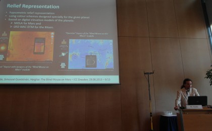
11G.2 “Blind Mouse” on Mars and Moon – a Map Game for Disseminating Planetary Topographic Knowledge (invited talk) (#288) – M. Gede (Eötvös Loránd University Department of Cartography and Geoinformatics, Budapest) et al.
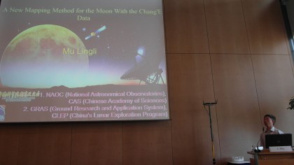
11G.3 A New Mapping Method for the Moon With the Chang’E-1 Data (#1456) – L. Mu et al. (National Astronomical Observatories, Chinese Academy of Sciences, Beijing)
Full presentation can be viewed here: Mu Lingli: A New Mapping Method for the Moon With the Chang’E Data A New Mapping Method for the Moon With the Chang’E Data
11:00 – 12:15: S12-G | Mixed Session
2G.4 GIS-mapping of Phobos based on new results of image processing of Mars Express data (#1075) – I. Karachevtseva et al. Speaker: S. Afanasyeva (State University of Geodesy and Cartography (MIIGAiK) Extraterrestrial Laboratory (MExLAb), Moscow).
12:15 – 12:45 P3 | Poster Session
P3.33 Geobrowsers vs. Cartographic Artworks: Virtual Planetary Globes Designed for K–12 Education (1252) – H. Hargitai et al.
P3.34 HIGH RESOLUTION VESTA LAMO ATLAS DERIVED FROM DAWN FC IMAGES (#623) – T. Roatsch et al.
P3.35 Cartographic Mapping of the Icy Satellites using Cassini ISS images. (#632) – E. Kersten et al. #706
P3.36 Main Characteristics of Coordinate and Cartographic Support of Luna-Glob Mission (#706) – Anatoliy Zubarev et al.
14:45 – 16:00: S13-G – Mixed Session
13G.1 Mapping Of Candidate Russian Landing Sites On The Moon (#1148) – A. Kokhanov (1Moscow State University aof Geodesy and Cartography MIIGAIK Extraterrestrial laboratory (MExLab), Moscow) et al.


